Introduction
In the western provinces, west of the red line in the lower middle figure, Paleogene and older aquifers contain hydrocarbons. East of the line, discoveries have only been made in local basins where the Jurassic source rock has been buried to a sufficiently high temperature to generate hydrocarbons.
In the eastern area, all the large aquifers have been selected based on the established criteria (section 3.3) and storage capacity is estimated by the method described in section 3.4. In the petroleum provinces, it is considered that exploration and production activities will continue for many years to come. The most realistic sites of CO2 storage will be some of the abandoned fields, in particular the gas fields. Consequently, an indication of the storage capacity of the fields has been given, but no aquifer volumes have been calculated. Some of the oil fields are considered to have a potential for use of CO2 to enhance oil recovery (EOR, section 8). Some of the CO2 used for EOR will remain trapped. The capacity for this type of CO2 trapping has not been calculated.
The Sognefjord Delta aquifer and the Statfjord Formation aquifer (figure) are developed both within the petroleum provinces in the west and as saline aquifers with small amounts or no petroleum in the east. In these cases, only the eastern parts have been evaluated for CO2 storage.
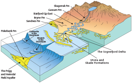
Fig-4-084
Conceptual sketch showing location of aquifers relative to depositional systems
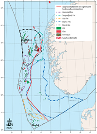
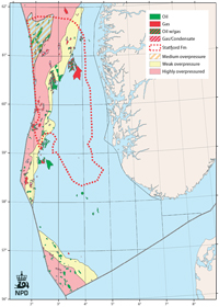
Fig-4-085
Distribution of major aquifers at the Jurassic levels relative to the petroleum provinces
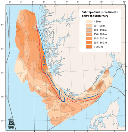
Fig-4-086
Thickness of Quaternary deposits and Jurassic subcrop
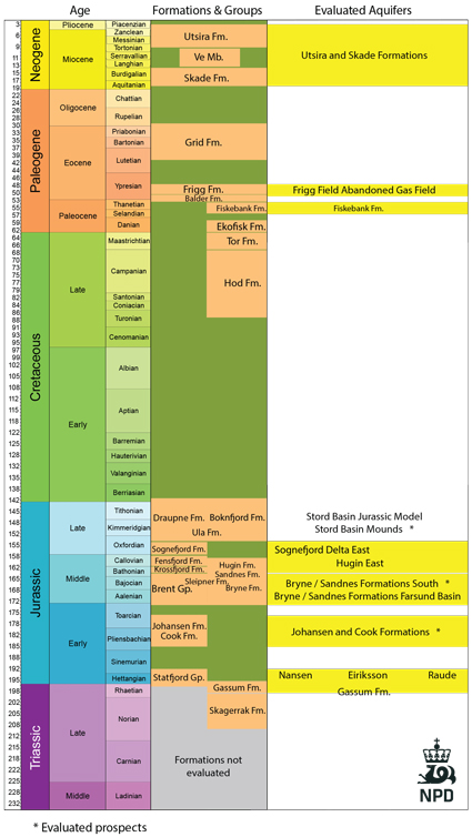
Fig-4-087
Stord basin - long distance CO2 migration
Paleogene Mounds, Stord Basin
The Hugin East Formation aquifer
The Utsira and Skade aquifer
The Bryne and Sandnes Formations
Egersund Basin case study
The Sognefjord Delta aquifer
The Johansen and Cook Formation aquifer
The Statfjord Group aquifer
The Gassum Formation aquifer and the Skagerrak Formation
The Fiskebank Formation aquifer (The Siri trend)