Large area with new released datasets in the Barents Sea
6/4/2024 The announced APA area in the Barents Sea has been expanded with 34 blocks, featuring good coverage thanks to recently released seismic data.
The Ministry of Energy announced APA 2024 on 8 May, including blocks in the North Sea, the Norwegian Sea and the Barents Sea. The deadline for applications is 3 September.
The predefined areas (the APA areas) in the Barents Sea have been expanded with 34 blocks. The expanded area in the Barents Sea is located on the Finnmark Platform and covers an area of just under 9000 square kilometres. The APA area in the Barents Sea has good coverage of 3D and 2D seismic data. Over the last five years alone, vast volumes of data have been released within the predefined areas.
Released 3D and 2D seismic data
The Norwegian Offshore Directorate has compiled a map of the seismic datasets released over the past five years (2019-May 2024) (Figure 1-2).
There is high data density of released 3D and 2D seismic data in the areas west of the Loppa High and around the North Cape Basin. The released data include several modern datasets. They were processed or reprocessed in 2020/2021 and include available data in both time and depth as well as "angle/offset stacks".

Figure 1: Overview of released 3D data in the Barents Sea over the last 5 years.
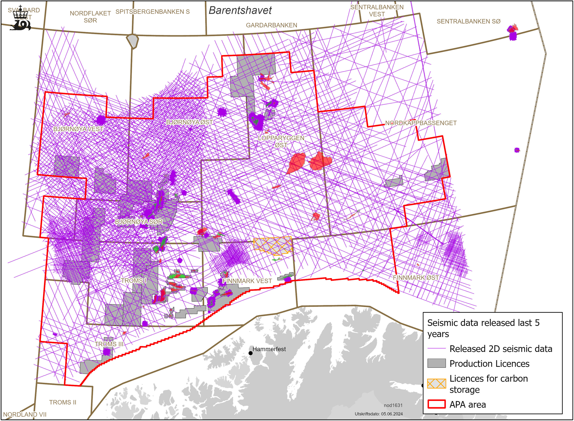
Figure 2: Overview of released 2D data in the Barents Sea over the last 5 years.
New acreage in the Barents Sea in this year’s APA
The expanded area on the Finnmark Platform includes several exciting plays that can be mapped for further maturing of prospects. The seismic line from the released 3D dataset FIN13 shows fault structures at basement level with potential structural and stratigraphic traps in the Billefjorden Group, as well as overlying spiculites in the Røye Formation (Figure 3). The Billefjorden Group and the Røye Formation are part of proven plays. On the other hand, the Norwegian Offshore Directorate considers them to be not mature and not well-explored.
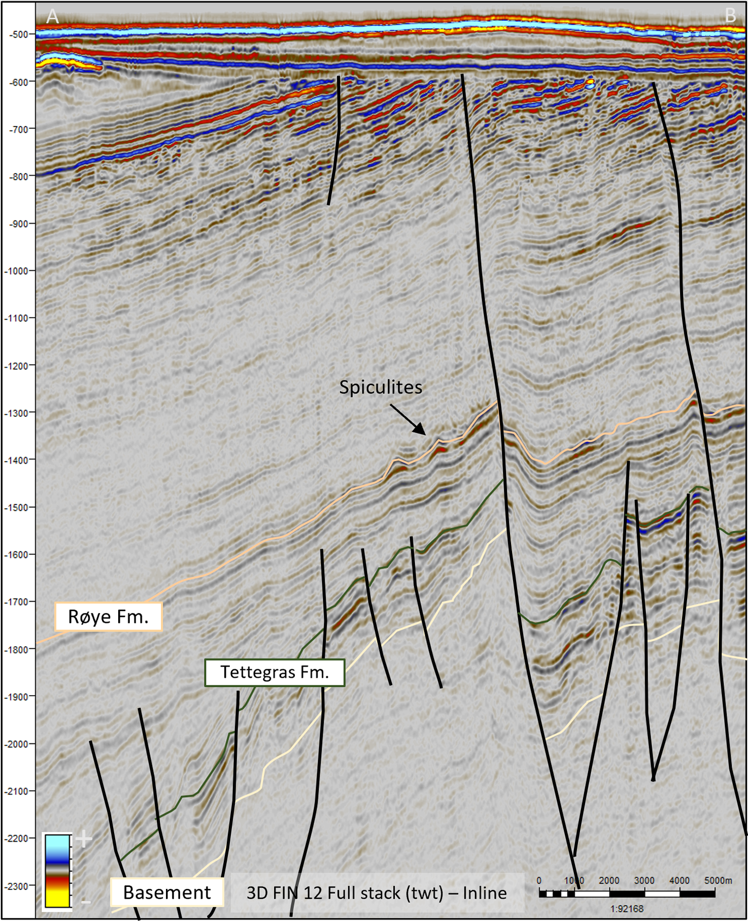
Figure 3: Seismic line (Fin13) showing fault structures at basement rock level.
Director Communication, public affairs and emergency response
Updated: 6/14/2024