2020 programme
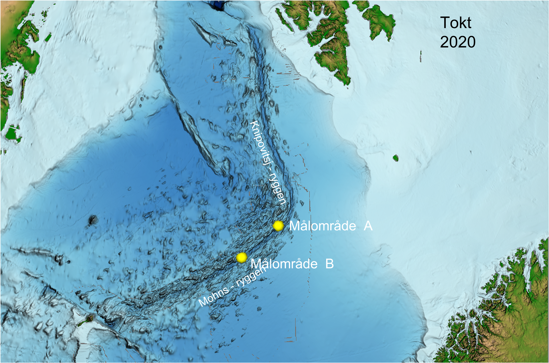
Shallow boreholes on the Fåvne, Gnitahei and Mohns Treasure deposits on the Mohns Ridge in the Norwegian Sea.
The seabed topography was very challenging and water depths exceeded 3000 m.
The assignment was realised very fast as a result of extra appropriations from the Government in connection with the ongoing Covid-19 pandemic.
Contractor
TIOS
Tool
Coiled tubing technology
Result
Drilled 50 metres of which 10 metres were cores. The low core capture wasdue to fractured rocks and difficult lithology to core. Significant amounts of ROV samples were also collected.
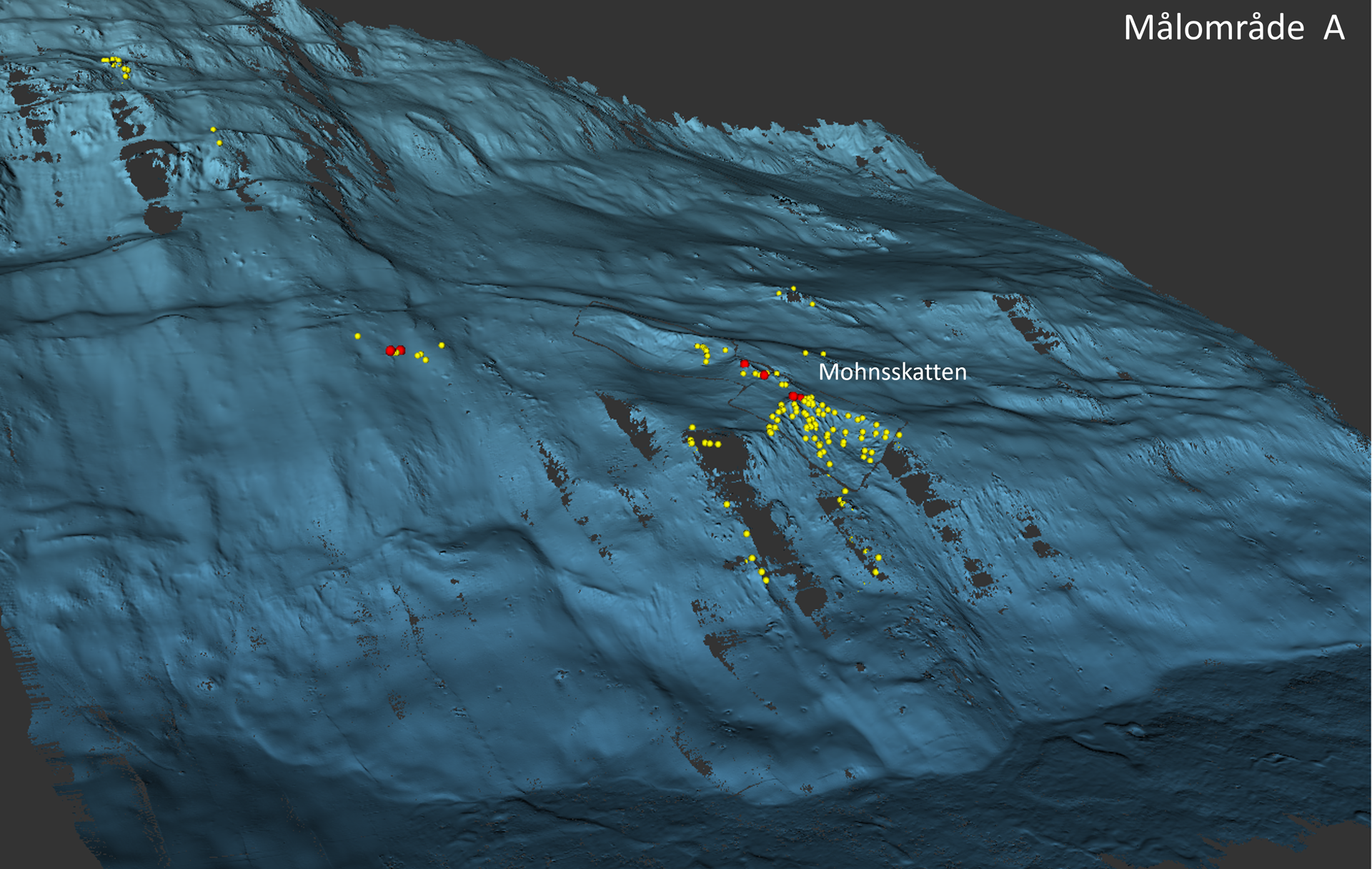
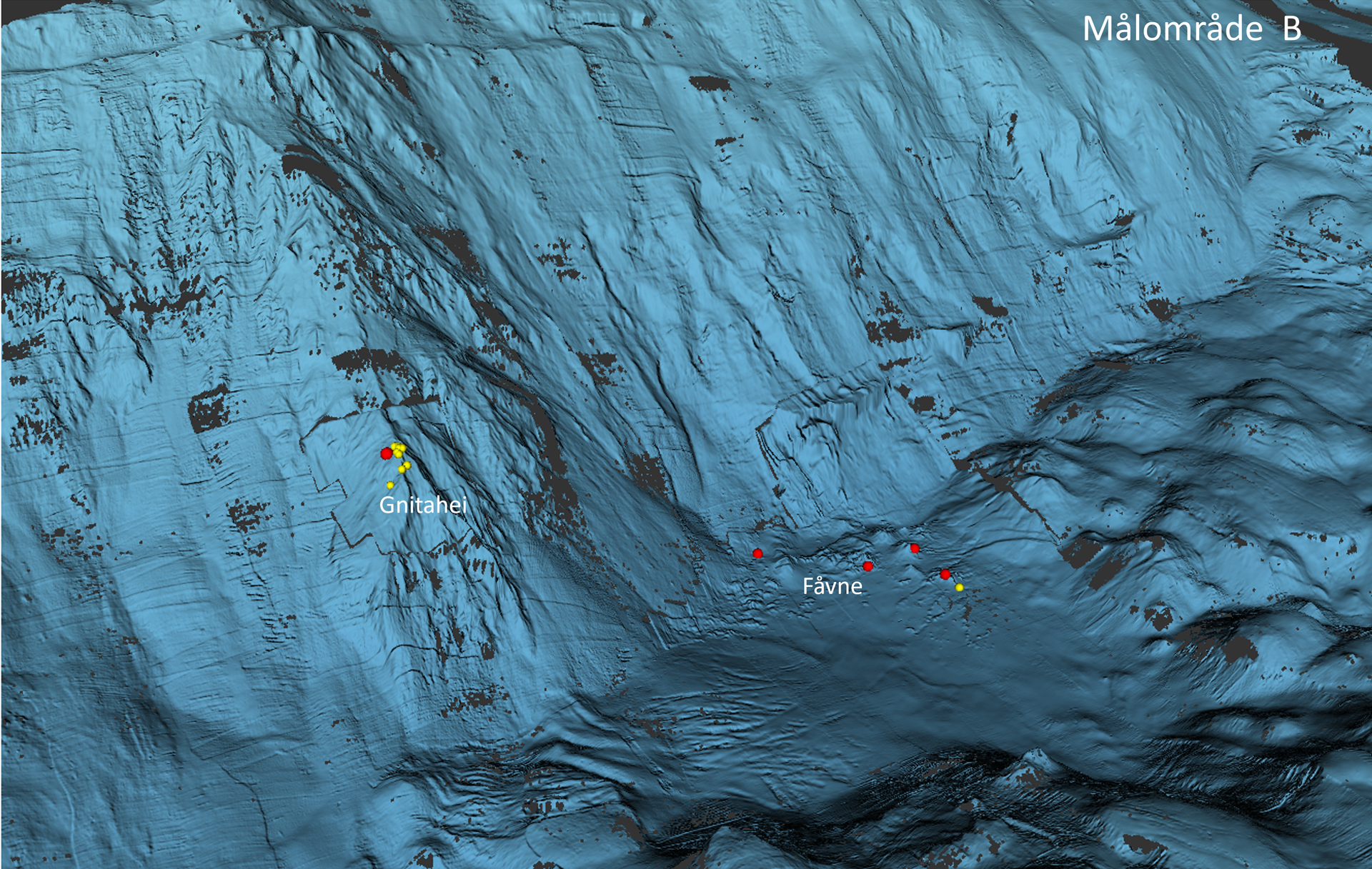
Detailed map of the mapping area
Area A at Mohns Treasure
Area B at Fåvne and Gnitahei
News about the expedition
Analyses reveal rich seabed minerals
Updated: 11/8/2021