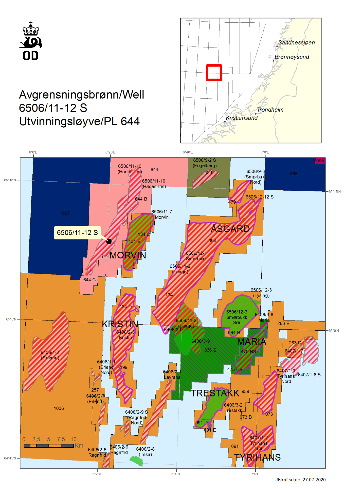
Delineation of gas/condensate discovery 6506/11-10 (Hades) near the Morvin field in the Norwegian Sea – 6506/11-12 S
7/28/2020 OMV Norway AS, operator of production licence 644, is the process of concluding the drilling of appraisal well 6506/11-12 S on the 6506/11-10 (Hades) gas/condensate discovery.
The well was drilled about five kilometres west of the Morvin field in the Norwegian Sea and 240 kilometres northwest of Kristiansund.
The discovery was proven in 2018 in Lower Cretaceous reservoir rocks (the Lange Formation). Before well 6506/11-12 S was drilled, the resource estimate for the discovery in the Lange Formation was between 3 and 23 million standard cubic metres (Sm3) of recoverable oil equivalents.
The objective of the well was to delimit the gas/condensate discovery in the Lange Formation toward the southwest, reduce uncertainty associated with the resource estimate, and to conduct a formation test.
The well encountered an interpreted gas column of about eight metres in the Lange Formation, with sandstone layers totalling about 83 meters with variable reservoir properties from poor to moderate. The gas/water contact was not directly encountered.
The operator's preliminary estimate of the size of discovery 6506/11-10 (Hades) is between 2 and 7 million standard cubic metres (Sm3) of recoverable oil equivalents. The licensees in production licence 644/644 B will assess the updated resources in 6506/11-10 (Hades) along with resources in the Middle Jurassic (Garn Formation) in the same discovery well, 6506/11-10 (Iris), for further follow-up.
The well was not formation-tested, but extensive data acquisition was carried out.
This is the second exploration well in production licence 644. This licence was awarded in APA 2011. Discovery well 6506/11-10 was drilled in production licence 644 B, which was awarded in APA 2015.
Well 6506/11-12 S was drilled to a measured depth of 4150 metres and a vertical depth of 4062 metres below sea level, and was terminated in the Lange Formation in the Lower Cretaceous.
Water depth at the site is 433 metres. The well will now be permanently plugged and abandoned.
The well was drilled by the Island Innovator drilling facility, which will now proceed to Hanøytangen shipyard.
Updated: 2/6/2025