New interactive map of deep sea data
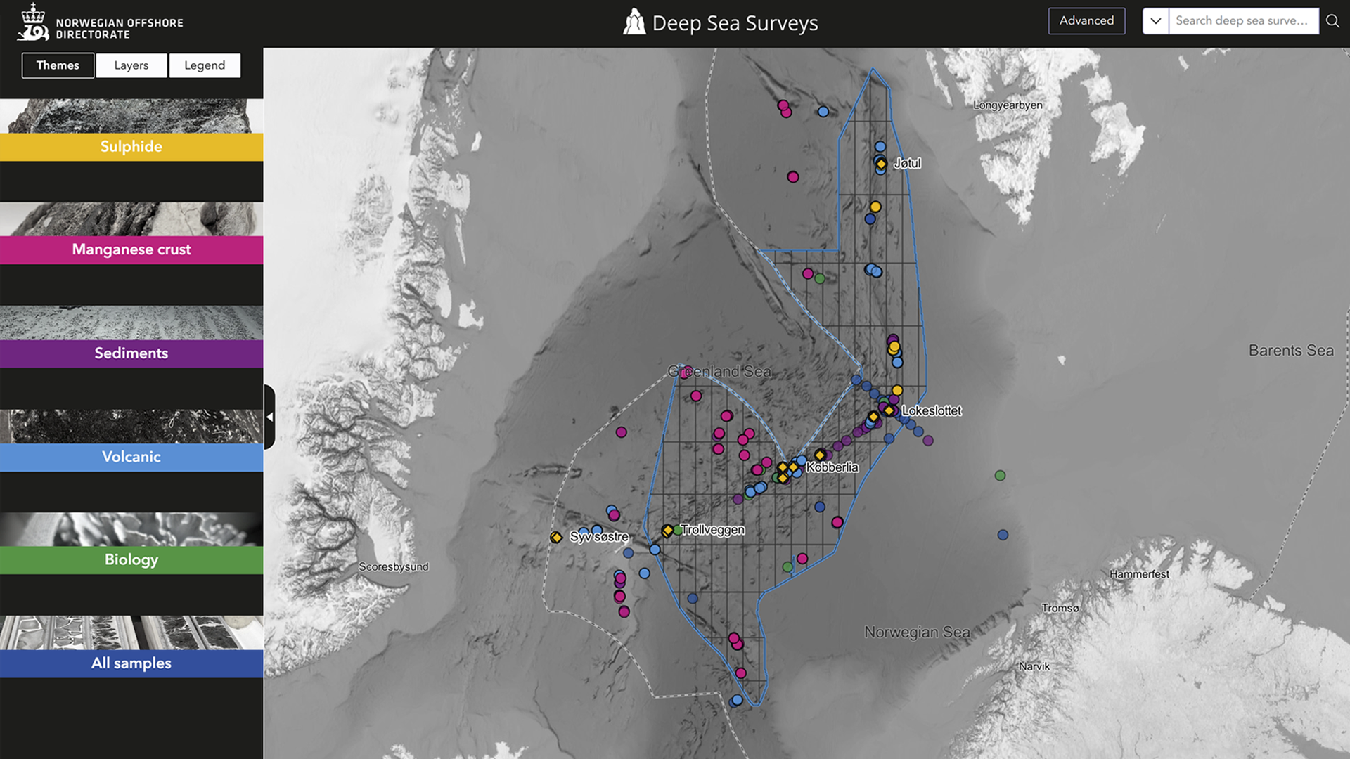
6/5/2025 Today, the Norwegian Offshore Directorate is launching an interactive map, Deep Sea Surveys.
It provides an overview of mapping and sampling carried out in the deep sea on the Norwegian continental shelf (NCS).
The data is published under the Norwegian Licence for Open Government Data (NLOD).
If you have any questions, please contact factweb@sodir.no
Updated: 6/5/2025
Latest news
New CCS guidelines
11/3/2025
The Norwegian Offshore Directorate has drawn up guidelines explaining how to fulfil the requirements in Section 26 of the Regulations relating to documentation in connection with storage of CO2 on the Norwegian continental shelf.
New report about power from shore
10/29/2025
Power from shore as replacement for gas turbines has been the most important abatement to reduce greenhouse gases emissions offshore.
Drilling permit for wellbore 7018/5-2
10/29/2025
The Norwegian Offshore Directorate has granted Equinor Energy AS drilling permit for wellbore 7018/5-2 in production licence 1236.
Drilling permit for wellbore 25/8-C-23 D
10/24/2025
The Norwegian Offshore Directorate has granted Vår Energi ASA drilling permit for wellbore 25/8-C-23 D in production licence 027.
Production figures September 2025
10/21/2025
Preliminary production figures for September 2025 show an average daily production of 1 991 000 barrels of oil, NGL and condensate.
Public consultation – proposed changes to two regulations
10/2/2025
The Norwegian Offshore Directorate is submitting proposed changes to the Resource Management Regulations and the Regulations relating to documentation in connection with storage of CO2 on the shelf for public consultation.
Drilling permit for wellbore 35/8-8 S
10/2/2025
The Norwegian Offshore Directorate has granted Harbour Energy Norge AS drilling permit for wellbore 35/8-8 S in production licence 248 LS og 248 B.
Popular tours of the Geobank during the Ulltra festival – celebrating the future
9/26/2025
At the end of September, the Norwegian Offshore Directorate participated in a brand-new festival at Ullandhaug - Ulltra 2025. Registered visitors had the opportunity to take part in a guided tour of the Geobank in our offices.
Seabed data from this summer’s cruise now available for order
9/26/2025
Orders can now be placed for data from this summer’s cruise in the Lofoten Basin (east of the Mohns Ridge) in the Norwegian Sea and the southwestern part of the Knipovich Ridge in the Greenland Sea.
Green light for export via gas pipeline from Troll B
9/25/2025
The Norwegian Offshore Directorate has granted consent for start-up of a tie-in from the Troll B platform to the Kvitebjørn gas export line.