Confirmed gas discovery in the North Sea (15/9-25)
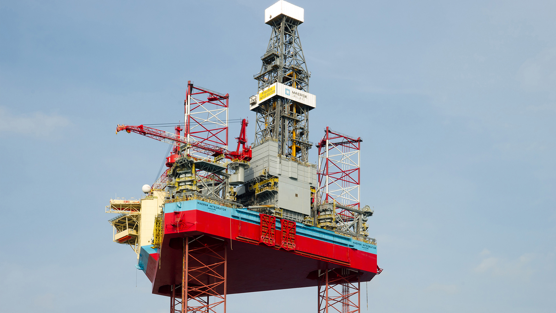
The well was drilled using the Noble Integrator rig, formerly Maersk Integrator. (Photo: Maersk)

The well was drilled using the Noble Integrator rig, formerly Maersk Integrator. (Photo: Maersk)

3/13/2024 Harbour Energy and its partners have confirmed a gas discovery in well 15/9-25 in the North Sea. This gas discovery has previously been proven in two other exploration wells.

The gas was first proven in wells 16/7-2 and 16/7-10, drilled in 1982 and 2011, respectively.

15/9-25 is the first well in production licence 1138, which was awarded in Awards in Pre-defined Areas (APA) in 2021.

The overall gas volume is calculated at between one and three million standard cubic metres (Sm3) of recoverable oil equivalent (o.e.).

The well was drilled using the Noble Integrator rig northeast of the Sleipner area, about 210 kilometres west of Stavanger.

Licensees Harbour Energy, Sval and Aker BP will consider whether there is a technical and financial basis for tying the discovery into existing infrastructure in the area.

Geological information

The primary exploration target for the well was to prove petroleum in Middle Jurassic and Triassic reservoir rocks in the Hugin and Skagerrak formations.

The secondary exploration target was to delineate gas proven in wells 16/7-2 and 16/7-10 in reservoir rocks in the Ty Formation from the Palaeocene.

In the primary exploration target, well 15/9-25 encountered a 22-metre thick layer of aquiferous sand with very good reservoir quality in the Hugin Formation in the Vestland Group. In the Ty Formation, the well encountered a 10-metre gas column in a 118-metre thick sandstone reservoir with very good reservoir quality. The gas/water contact was encountered 2330 metres below sea level, which confirms the contact encountered in nearby wells.

The well was not formation-tested, but extensive data acquisition and sampling were carried out.

Well 15/9-25 was drilled to a measured depth of 2872 metres below sea level, and was terminated in the Smith Bank Formation in the Upper Triassic.

Water depth at the site is 84 metres. The well has been permanently plugged and abandoned.
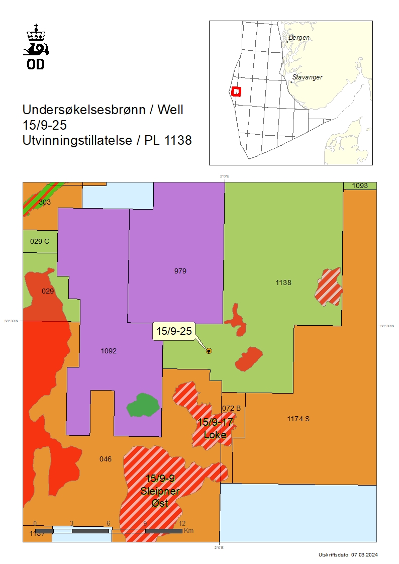
Map showing the location of well 15/-025.


Contact

Ola Anders Skauby

Director Communication, public affairs and emergency response

Tel: +47 905 98 519

Updated: 6/27/2024

Latest news

Renewed interest in exploring under the basalt
10/15/2026 Undiscovered oil and gas resources may be present under the volcanic rock basalt in the western part of the Norwegian Sea. However, no exploration wells have been drilled in these areas.
Oil and gas discovery in the North Sea (30/8-7 S)
10/14/2026 Equinor and its partners have discovered oil and gas in the “Grimsnes” prospect in the Oseberg area, about 140 km west of Bergen.
Production licences: We are transitioning to Altinn
10/13/2026 Starting on 21 October, applications and notifications on decisions associated with production licences must be submitted via Altinn. This will simplify the process for the companies.
Appraisal well in the North Sea increases projection (16/1-EA-4 H)
9/25/2026 Aker BP and its partners Equinor and DNO have drilled an appraisal well on the "Verdandi" and "Lillefix" discoveries in the North Sea. This well increases the projected discovery size.
Production figures August 2026
9/22/2026 Preliminary production figures for August 2026 show an average daily production of 2 073 000 barrels of oil, NGL and condensate.
Aker BP has made a gas discovery in the North Sea (36/4-2 and 36/4-2 A)
9/16/2026 Preliminary calculations show that the size is between 0.15 and 2.4 million standard cubic metres of recoverable oil equivalent (Sm3 of o.e.), which corresponds to 1-15 million barrels.
Drilling permit for wellbore 25/9-5 S
9/15/2026 The Norwegian Offshore Directorate has granted Equinor Energy AS drilling permit for wellbore 25/9-5 S in production licence 1042.
Growing exploration interest
9/11/2026 The authorities have received applications from 21 companies in the Awards in Predefined Areas (APA) 2025. The deadline for applications was 1 September.
New NCS map 2026
9/8/2026 You can now download or order a printed version of the Directorate's most recent map of the Norwegian continental shelf (NCS).
Resource report 2026 in English
9/8/2026 The Resource report is now also available in English.